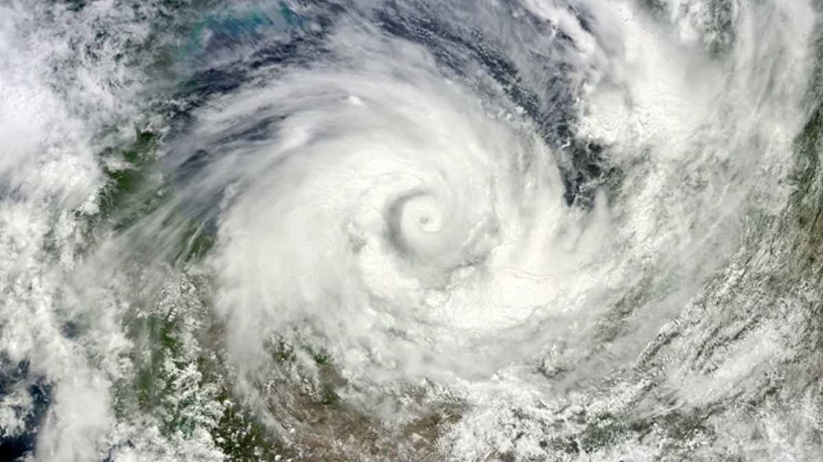
Meteorologists are monitoring the Pacific intensively as indicators suggest that La Niña might emerge this autumn. Colder sea temperatures in tropical regions frequently cause changes in worldwide weather, deflecting the jet stream and modifying seasonal trends throughout America. Although the occurrence may be milder and briefer than previous episodes, its possible impacts on precipitation, temperatures, and storm activity are currently capturing focus from climate scientists who caution that minor variations can still spread extensively through atmospheric systems.
What this pattern is and how it forms
The El Niño–Southern Oscillation, or ENSO, flips between warm and cool states in the tropical Pacific. The cool state is the system’s cold phase. In that mode, trade winds, clouds, and pressure shift in tandem with ocean changes. The Pacific jet stream then responds. Because ocean and atmosphere couple tightly, small sea temperature shifts can alter large-scale weather.
By definition, the Niño region in the east-central Pacific sets the bar. According to the National Weather Service, warm conditions occur when sea surface temperature sits 0.9°F (0.5°C) above the long-term average. Cool conditions occur when it falls 0.9°F below it. The atmosphere must also align, since winds and pressure confirm the phase. Those signals steer storm tracks.
The cold phase, La Niña, nudges the Pacific jet stream northward. That placement sets the stage for wetter odds and cooler winters across the northern tier. The southern tier often trends warmer and drier. Because Atlantic wind shear weakens in that setup, hurricane activity can ramp up. Impacts vary by region. Local terrain and short-term patterns still matter.
How La Niña steers the jet stream and day-to-day weather
When the jet stream slides north, storms ride that path more often. The northern U.S. then sees more frequent systems and higher precipitation chances. Air masses tilt cooler, especially when Arctic intrusions link up with those tracks. Because timing matters, early‐season cold can follow fast behind stronger fronts.
Farther south, storm tracks miss more often, so dry spells can lengthen. Daytime highs can run warmer, while nights may stay mild. That mix stresses soils and can tug at water reserves. Because background climate is warmer, heat can compound. Local relief still arrives when fronts dip south, yet the bias remains.
Over the Atlantic, the cool Pacific phase changes wind patterns aloft. Shear can ease, so tropical systems face fewer headwinds. Activity then tends to increase. Forecasts still hinge on ocean heat, dust, and steering currents, so year-to-year outcomes vary. Coastal risks depend on tracks, not basin totals. Preparedness matters while the season evolves.
Practical impacts, risks, and habits to adjust this season
For northern communities, an active storm corridor raises rain and snow chances. Roads, roofs, and rivers feel that pressure, so maintenance pays off. Because cold snaps can stack with stormy spells, energy demand may spike. Homes and grids benefit when efficiency and backup plans are in place. Simple steps help when timing turns sharp.
In the southern tier, warmer and drier tendencies test reservoirs and soils. Ranchers and growers watch weekly moisture, since deficits build quietly. Because heat can ride along, outdoor work and health planning matter. Local forecasts guide irrigation and wildfire awareness. Short bursts of rain still arrive. However, the broader tilt favors dryness without persistent storm tracks.
Coastal residents track tropical updates more closely. A busier basin does not guarantee local landfalls, yet exposure rises. Because steering currents decide risk late, early readiness matters most. Kits, insurance checks, and evacuation routes save time when warnings come. Communities that plan early recover faster. During La Niña, those steps carry extra value.
Signals, numbers, and why a brief La Niña may not count
Recent guidance points to fall and early winter timing, with limited strength. NOAA and the National Weather Service describe a weak, short-lived phase. Records are unlikely to fall. The emphasis stays on pattern nudges rather than extremes set by the phase alone. Background warming still shapes baselines, so context is essential.
Official classification rests on sustained thresholds. The Niño region must stay 0.9°F below average for at least five consecutive overlapping three-month periods. The atmosphere must confirm the shift. If the cool anomaly holds for only three such periods, the event does not enter the historic ledger. Yet sensible weather can still reflect the pattern.
Last winter offered a preview. Cool-phase signals appeared, then faded before meeting duration rules. Impacts still resembled a moderate event in places, according to forecast discussions. Because the ocean-atmosphere link can pulse, brief windows deliver noticeable effects. Monitoring helps, since the jet stream reacts quickly when the Pacific cools enough.
What last winter taught us and how to read the next updates
Forecasters expected cool-phase development the prior summer. Conditions waited until December to arrive. That delay left little runway to build strength before winter. Because timing shapes impact, the late turn limited the season-long imprint. The message remains: timing changes outcomes as much as absolute magnitude.
Warmer-than-average ocean temperatures likely slowed the onset. Earth spent May 2023 through March 2024 in a warm phase, El Niño. That background pushed global heat to record levels during that span. Climate change adds steady warming regardless of ENSO’s swing, so baselines rise even as phases flip. The cool phase cannot erase that trend.
The official ledger stayed blank because thresholds were not met for long enough. Current outlooks lean toward only three qualifying three-month periods this time. That count falls short of the rule. A short La Niña can still shape jet streams, rainfall, and risks, as the Becker comment underscores. Expect influence, not a blockbuster.
What to remember now that signals point to a cool Pacific season
If La Niña emerges on schedule, expect nudged patterns rather than headline-breaking extremes from the phase itself. Northern areas lean wetter and cooler, while southern areas tilt warmer and drier. The Atlantic may find more support for storms. Because official status needs time, the phase might not enter the record, yet planning still benefits.
